Aerial Wildlife Surveys Designed for Texas Landowners
Professional drone-based wildlife surveys throughout Texas providing aerial wildlife observations, property mapping, imagery, and documented survey results for ranches, landowners, and wildlife management projects
Safe, Efficient, and TPWD-Compliant Wildlife Survey Operations
HOW IT WORKS
Property Consultation
We discuss your property, acreage, survey goals, and the type of wildlife information you are looking to document.
TPWD Permitted Survey Scheduling
Survey operations are scheduled in accordance with property conditions, wildlife activity, weather, and applicable Texas Parks and Wildlife Department permitted survey requirements.
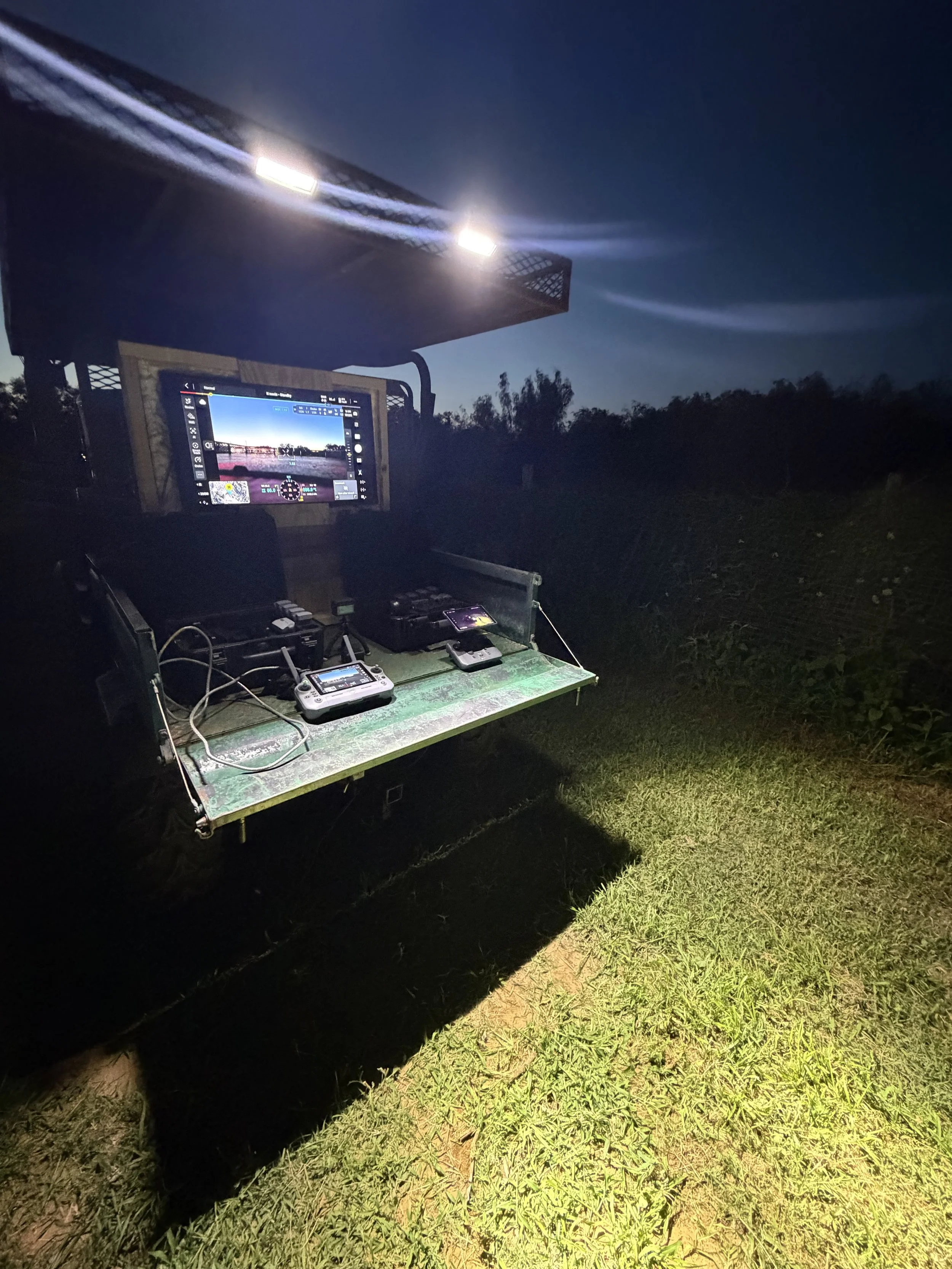
Drone Wildlife Survey
Using permitted and compliant drone operations, we conduct aerial wildlife observations, capture imagery, and document notable activity throughout the property.
Receive Your Survey Results
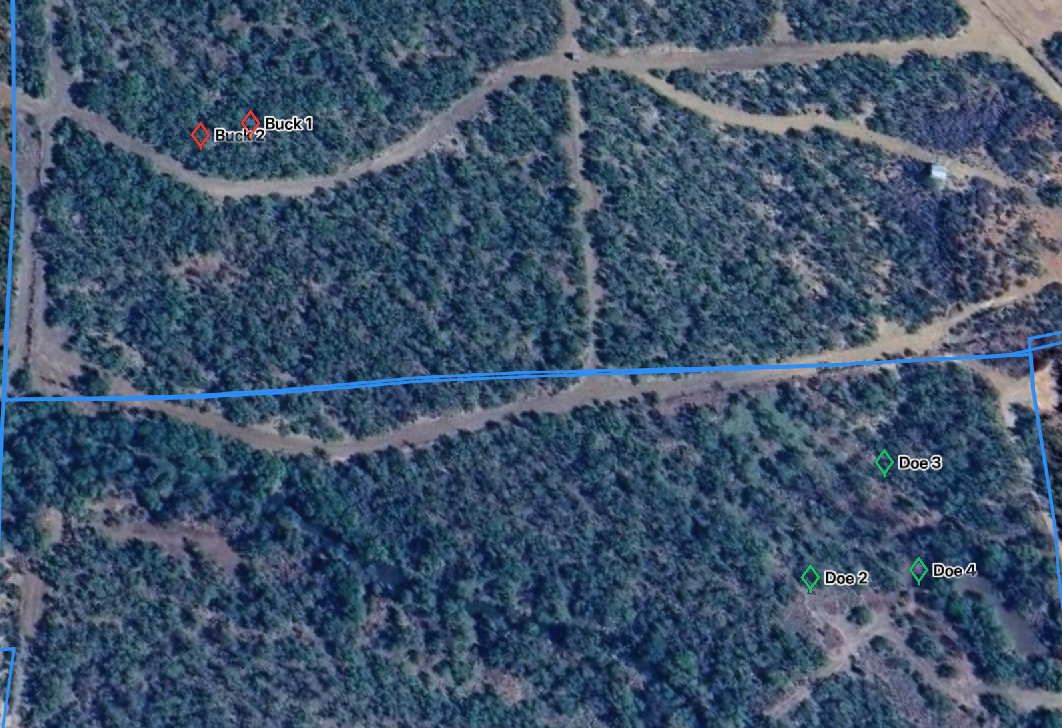
You receive organized deliverables that may include wildlife counts, aerial imagery, photos of notable animals, mapped observation points, and property visuals.
TPWD-approved and permitted wildlife survey operations
Ability to survey large ranches and remote properties
High-resolution aerial imagery and documentation
Property mapping with pinned observation locations
Minimal disturbance to wildlife during operations
Wildlife counts and activity observations
Professional reporting and organized deliverables
Why Choose IronHawk Solutions for Wildlife Surveys ?
Ranch Owners-Gain valuable insight into wildlife activity, habitat conditions, and animal movement across large properties
Hunting Operations & Outfitter-Monitor wildlife populations and property activity to support management decisions and improve hunting experiences
Landowners-Better understand wildlife presence, property conditions, and notable animal activity through professional aerial documentation.
Wildlife Managers-Use aerial survey data, imagery, and mapping to assist with wildlife monitoring and land management planning.
Real Estate & Ranch Brokers-Provide potential buyers with detailed aerial visuals and wildlife information that help showcase the value of recreational and ranch properties.
Property Investors-Document land conditions, wildlife activity, and property features to support property evaluation and planning decisions.
Who benefits Wildlife Surveys?